Featured projects
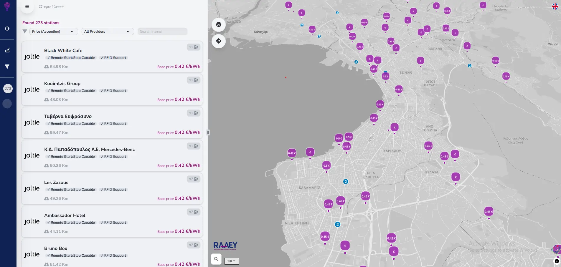
01 / 13 · Web-Map · E-Mobility
ChargingCost.gr
ChargingCost.gr is developed for the Regulatory Authority for Waste, Water, and Energy of Greece. It facilitates the discovery of public EV charging stations in Greece, ranking them based on their comparative charging price. Developed for Geospatial Enabling Technologies, all rights reserved
- React
- MapLibre
- PMTiles
- EV
- E-Mobility
- OCPI 2.0

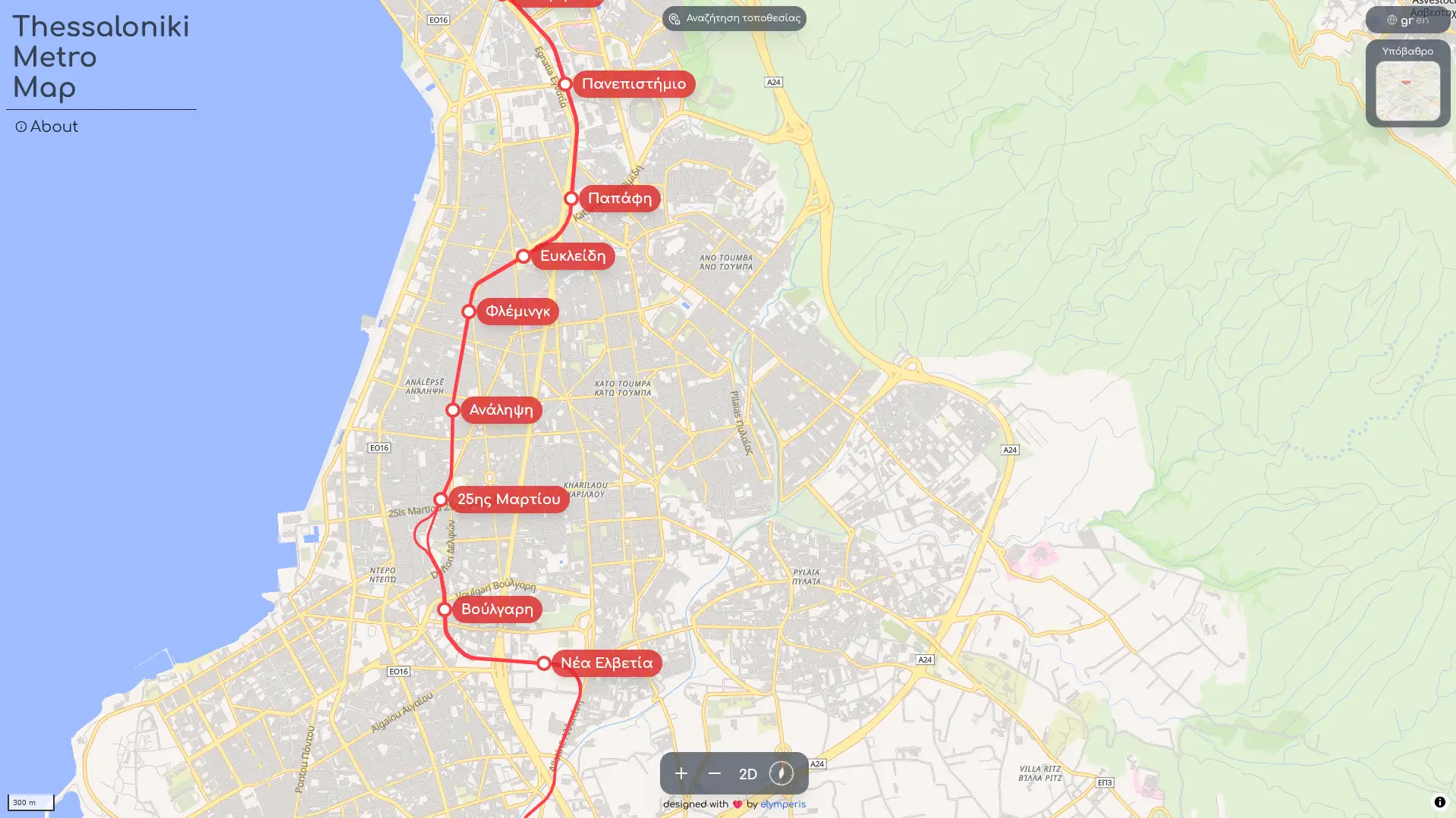
02 / 13 · Web-Map · Transportation
Thessaloniki Metro Map
A simple interactive map for the Thessaloniki Metro. Functions as a PWA, and is built with MapLibre, React, and OpenFreeMap data. Featured in Parallaxi magazine
- MapLibre
- Transportation
- PWA
- Web-Map
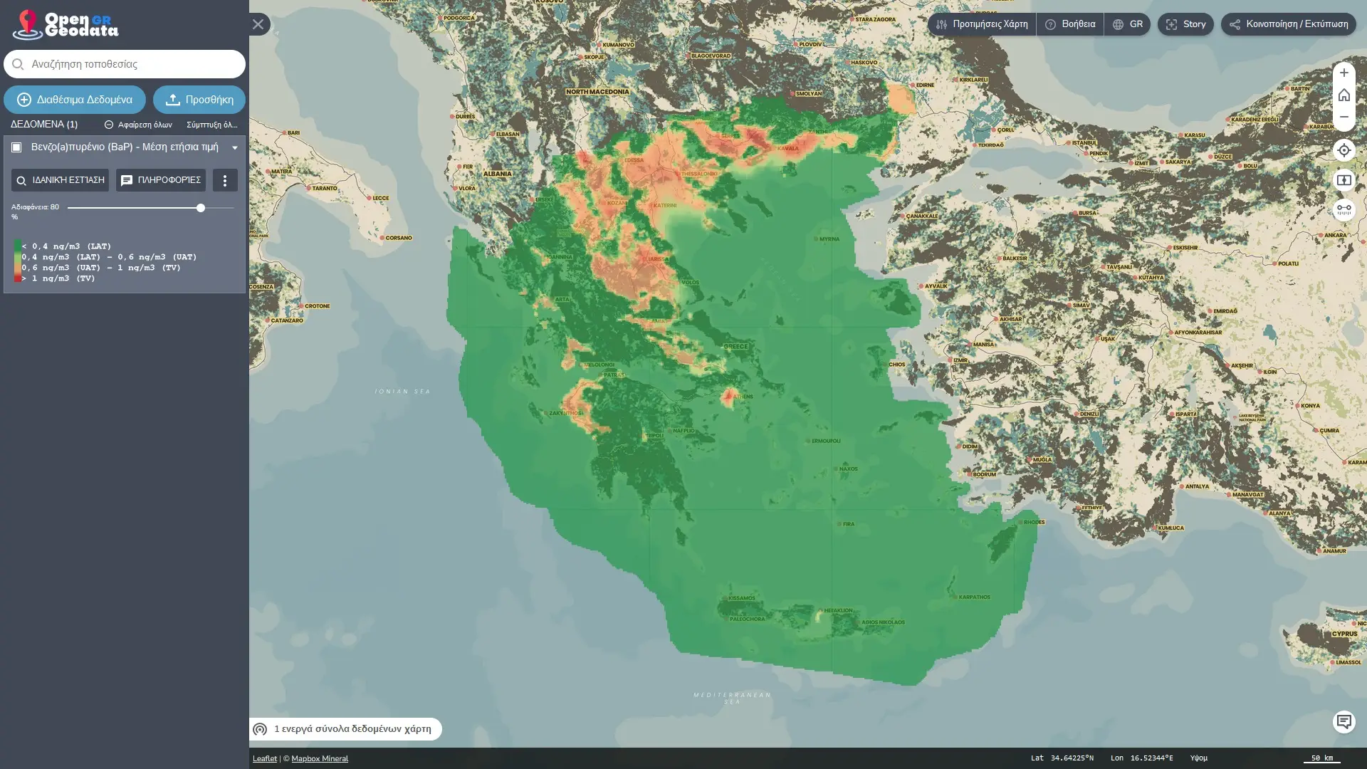
03 / 13 · SDI · Data Portal
Open Greek Geodata
A one-stop-shop for greek geodata sources. This project unifies a multitude of government & research-funded sources of geodata related to Greece, and serving them through a lightly customized version of the amazing TerriaJS SDI Portal.
- TerriaJS
- React
- NodeJS
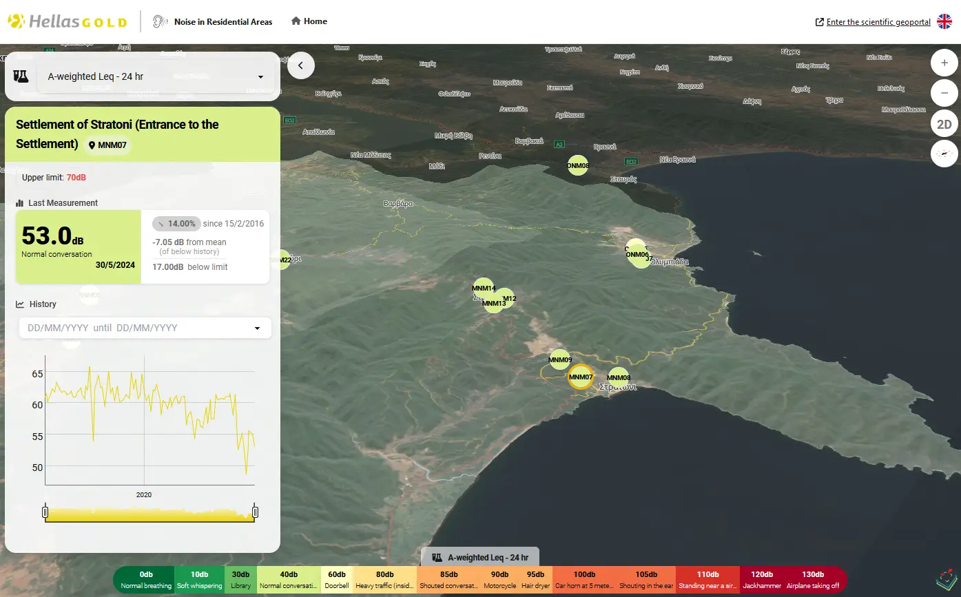
04 / 13 · Web-Map · Sustainability
Environmental Monitoring Portal - HellasGold
A new environmental monitoring platform for Hellas Gold SA, featuring a user-friendly interface and 3D, next-day monitoring of key parameters of the company's environmental monitoring and rehabilitation program. Developed by Geospatial Enabling Technologies, all rights reserved
- Environmental
- React
- MapLibre
- Django
- Sustainability
05 / 13 · Storymap · Web-Map · Data Visualization
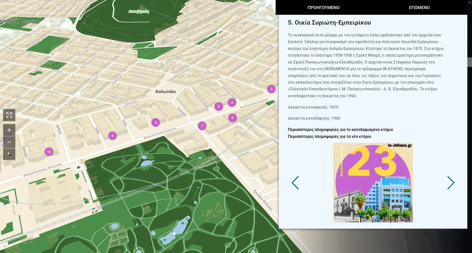
in-Athens Storymaps
A storymap app built from scratch with Vite, MapLibre & PMTiles, for the in-Athens project. Developed for Geospatial Enabling Technologies, all rights reserved
- Vite
- MapLibre
- PMTiles
06 / 13 · QGIS · Data Integration
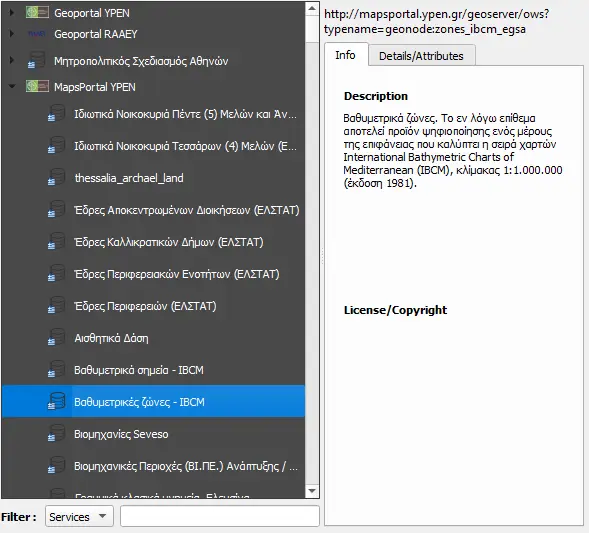
GreekData QGIS Plugin
Integrate open geodata from public authorities of Greece into QGIS
- QGIS
- Python
- PyQt5
- OGC Web Services
07 / 13 · Web-Map · Data Visualization · Weather
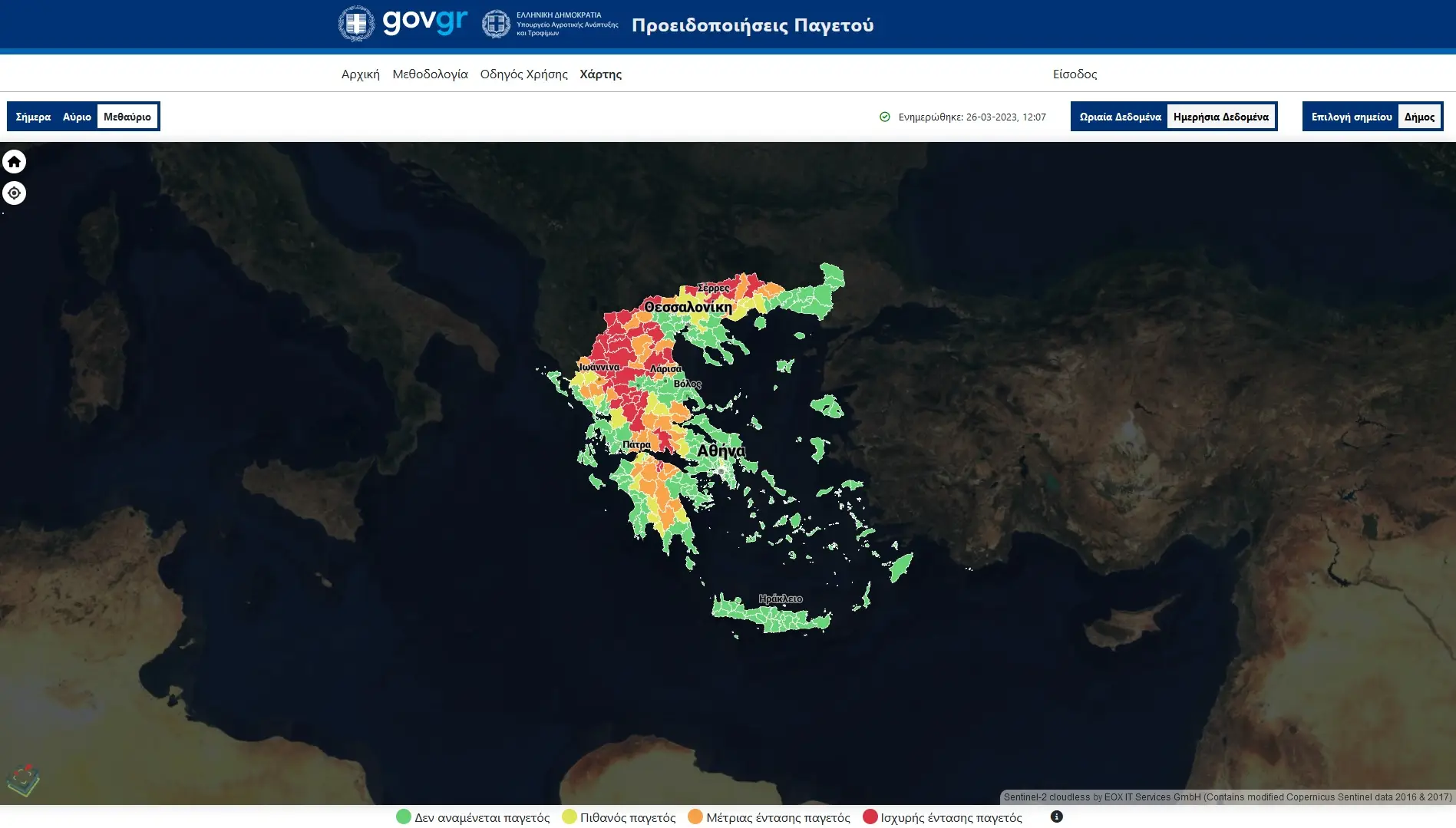
Frost Alerts
A frost alerting system for the Ministry of Agriculture of Greece, leveraging 3-day forecast data from ECMWF. A spatial, terrain-dependent, densification algorithm developed jointly by GET and the National Meteorological Agency of Greece, providing high-res forecast data in a 500X500m grid. The system provides alert levels (0-3) in either a geographical grid, or per administrative unit (using raster statistics) and also features personalized notifications. Developed for Geospatial Enabling Technologies, all rights reserved
- PostgreSQL
- Python
- GDAL
- Meteo
- GRIB
- Rasterio
08 / 13 · QGIS · Data Integration
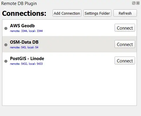
QGIS Remote DB Plugin
A simple plugin to manage SSH connections to remote database servers from QGIS.
- QGIS
- Python
- PyQt5
09 / 13 · QGIS · Hydrology
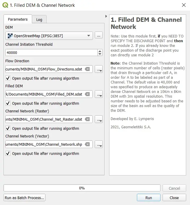
Watershed Analysis Toolbox
A QGIS plugin to automate a great deal of processes required for hydrological analysis, as they are required by Greek law. It includes 4 main modules which perform several tasks, from watershed and drainage delineation to Curve Number estimation and ICN curve parameters generation.
- QGIS
- Python
- PyQt5
- SAGA GIS
- Hydrology
- Optimiser
10 / 13 · Website
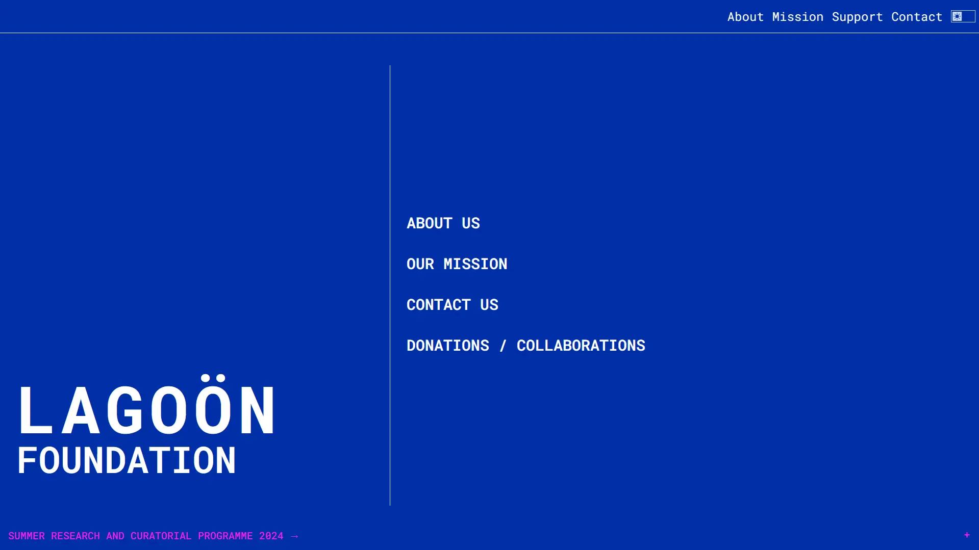
Lagoon Foundation
Lagoon is an art foundation based in Pylos, GR, created by Ifigeneia Pouliadou while studying in Kingston University London Art Bussiness school.
- Website
- Art
- Design

11 / 13 · QGIS
QBeachball
A QGIS plugin for seismic focal mechanism plotting.
- QGIS
- Python
- PyQt5
- Seismology
12 / 13 · Website · Wordpress
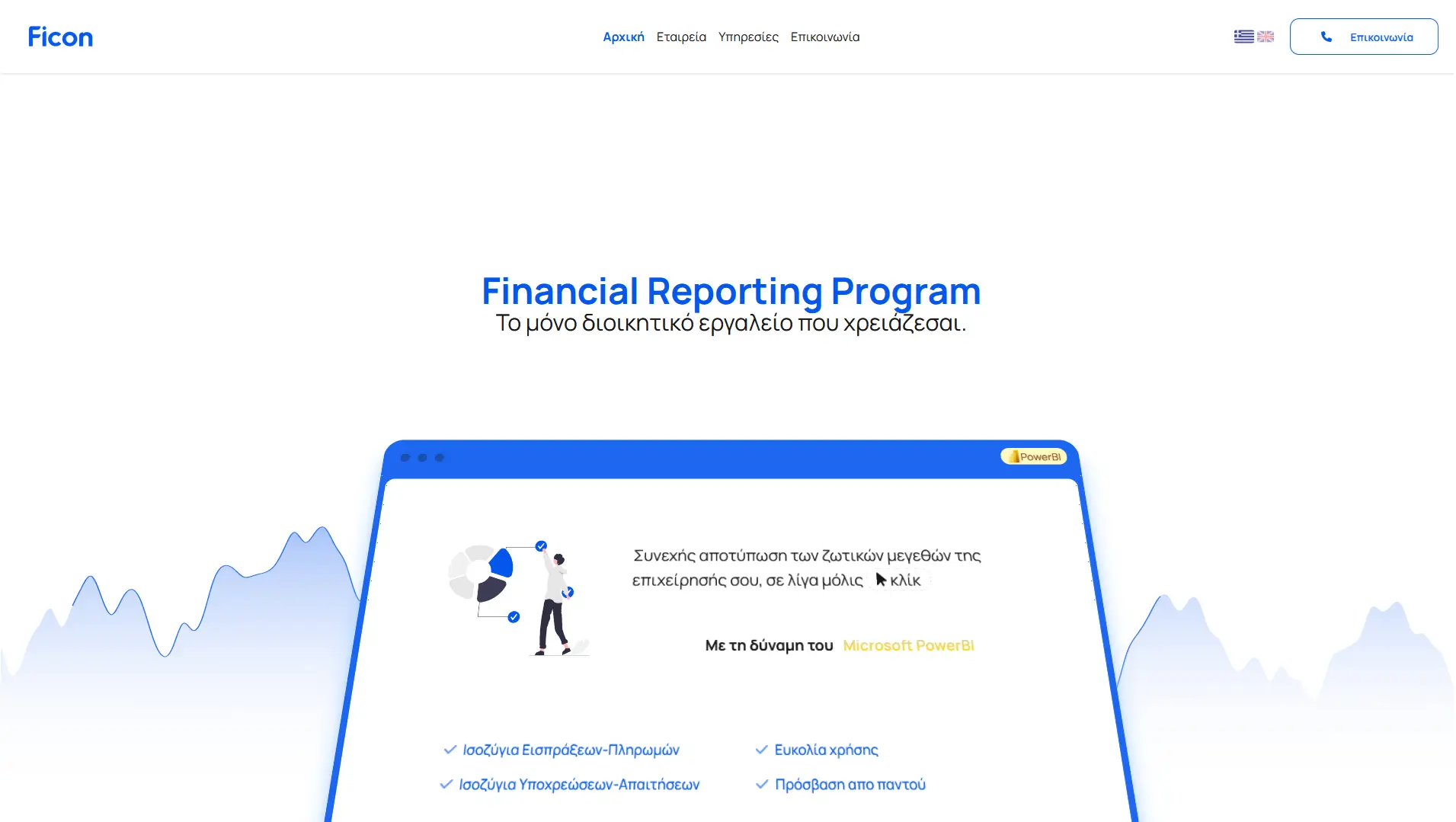
Website for Ficon
Ficon is an innovative financial consulting company based in Thessaloniki, Greece.
- Website
- CMS
- NextJS
- Design

13 / 13 · Website · Wordpress
Website for Just Health
Modern website for Just Health, a health and para-pharmaceutical company based in Thessaloniki, Greece.
- Website
- CMS
- NextJS
- Design